

 General
 The BBC Weather site
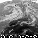 |
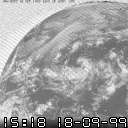
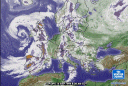
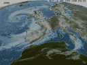
Europe Meteosat infra-red view of North-west Europe and North Africa. Combine it with the synoptic chart below. |
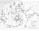 |
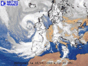
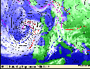
Synoptic Chart Met Office synoptic chart imported from Wetterzentral, Denmark updated every 6 hours |
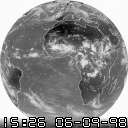 |
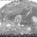
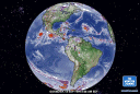
Global Meteosat infra-red global view |
 |
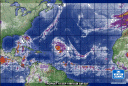
Australia & New Zealand GMSS infra-red view of Australia & New Zealand |
 |
Japan & China GMSN infra-red view of Japan and eastern China |
 |
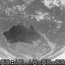
North America GOES satellite infra-red view of North America |
 |
University of Nottingham Satellite Index Thumbnail Index of all the Meteosat images from the University of Nottingham. This is an excellent site if you are not sure what images you want. The images above are all from this site. |
 |
Europe UK Met Office Meteosat infra-red image updated every 6 hours |
 |
Europe Meteo France (French Met Office) colour enhanced Meteosat image of North-west Europe |
 |
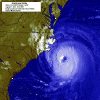
Tropical Atlantic Weather Channel colour enhanced image of the tropical Atlantic - good for hurricanes |
 |
Europe Weather Channel colour enhanced image of Europe |
 |
Western hemisphere Weather Channel colour enhanced image of Western hemisphere |
 |
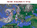
Synoptic Chart Colour image of North-west Europe plus cloud overlay from the Met Office updated every 24 hours |
 |
Europe U.S.A.F. satellite image of Western Europe colour enhanced and combined with fronts/weather symbols |
 |
Europe Meteosat colour enhanced image of North-west Europe from a company called Meteotest. |
 |
UK Rainfall Radar UK Met Office rainfall radar images for the UK. This shows not the clouds but where the actual rain is falling. Can be usefully combined with cloud images and synoptic charts. |