The High Peak Trail follows the route of the old Cromford and High Peak Railway. It is mostly flat but exposed to high winds. You can cycle for as far as you like but here I describe the route to the top of the trail and back. You do not need a Map or instructions. Just remember to take the left fork through the tunnel after Parsley Hay on your return.
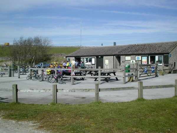
Join the trail at Middleton Top car park (50p Honesty Box and large field extension car park for busy times). The car park is off the B5035 Cromford to Carsington Water road. If it turns out cold and wet you can visit Arkwright 's Mill in Cromford, Chrich Tramway Museum or Riber Castle instead.
The visitor centre has a shop, toilets and bicycle hire facilities. These are open week-ends only out of season.
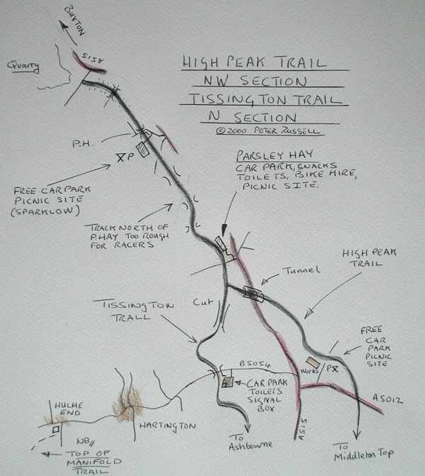
Disabled Facilities: These are best at Parsley Hay. Hire of specially adapted cycles is available. These can be used on the smooth tracks running south, preferably the Tissington Trail since it is wider, but the rougher track to the north is best avoided.
Near the visitor centre you will find the old winding engine house (engine in steam first Sunday of the month) for the incline. Do not cycle down the steep incline but go in the opposite direction. If you are new to trail cycling please read the advice given in on the Advice page.
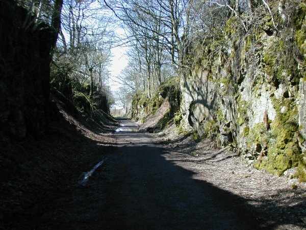
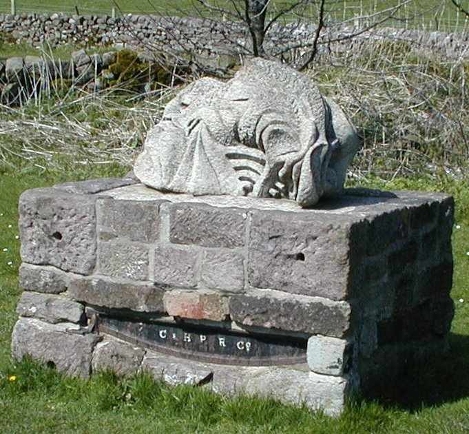
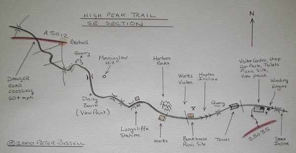
Cycle West and cross a gated minor road. Please shut all gates. Cycle through the first of two tunnels and past the quarry to Hopton incline. This is the only steep part of this route and can be walked up in 5 minutes. Have a rest at the top of the incline. Notice the sculpture and the bunkhouse. I don't know how the trains got up this incline I can see no evidence of a winding engine. Cross the drive to the Viaton site and carry on the level trail.
Pass a small works on the left and Harboro rocks on the right. There are sometimes climbers practicing here and also sometimes clay pigeon shoots from the hut. In a short while you come to Longcliffe Station. Note the loading ramp on the left.
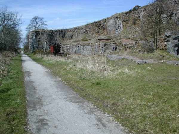
The next section travels along a number of steep embankments. Children should not be allowed to climb on the walls as some drops are 40 feet or more. Stop and read the view-point board at Daisy bank. There is an old crane at the quarry and this makes a good site for picnics being about half way up the trail.
The next obstacle is the main A5012 Cromford to Buxton road. This is very busy and traffic travels along it at more than 60 mph. Beware of cars, stone lorries and fast motorcycles. Shortly after crossing the road you come to Fridden Brick Works and car park. Continue on the trail past Brundciffe farm (small caravan site) and pass though the second tunnel.
Just after the tunnel exit the Tissington Trail joins from the left. In a few hundred meters you arrive at Parsley Hay. Here you will find a car park, picnic site, cycle hire and snack bar (when the snack bar is closed the cycle hire people do tea and coffee).
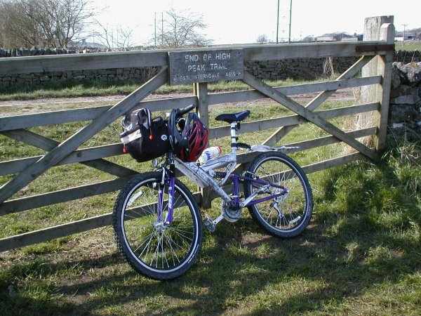
If you return to Middleton top from Parsley Hay you will have cycled 23 miles and this will be more than enough for a days ride for a beginner. The more energetic can carry on to the top of the trail. The trail north of Parsley Hay is not recommended for non-mountain bikes but you could travel slowly to the next car park and visit the nearby pub. There are noticeable slopes on this top part of the trail. The trail ends abruptly near Streethouse Farm. You are now about 15 miles from Middleton top. This is where I usually find that the wind has moved round to the south-east and will be in my face as I return down the trail.
Maps:
SE Section:
North Section:
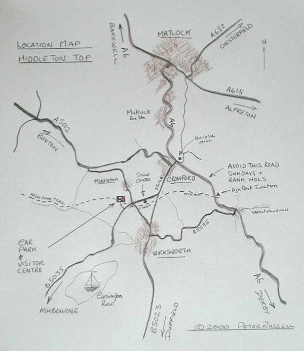
Location of Middleton Top:
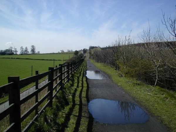
And here's another picture of the trail, these pictures were taken after heavy rain and the trail is usually dryer than this!: