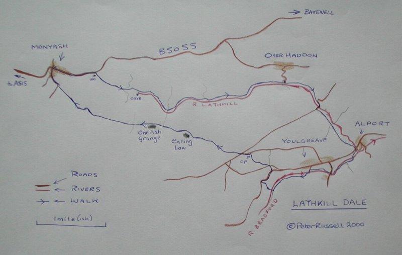
This is a circular walk of 7 miles. It should take around 3 hours but that depends on how fast you walk. If you walk faster than 2 miles per hour you might as well go to the gym and use a walking machine. The idea is to see things! Link to Walking in Derbyshire Advice.
Monyash is signed from the A515 Buxton to Ashbourne road. Street parking is available near the green in Monyash. Walk down the road east from the village (from the green walk down the main road past the church). Use the left hand grass verge to walk down to a depression in the road where you will find a lay-by with more parking and two poorly designed w.c.s. Cross the road and through the kissing gate to walk down the dry valley. Dry valleys are a characteristic of limestone country, the stream that made them having disappeared underground.
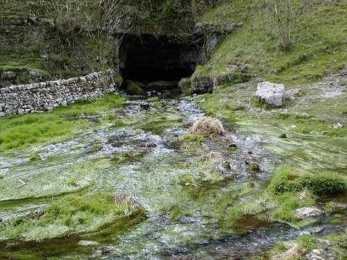
After a stone style and another kissing gate you are lead into a steep sided gorge. Cross a rock fall, mind your step a twisted ankle would not be pleasant. A squeeze style leads you further down into the valley. After a while you will find a cave on your left, from which emerges the river Lathkill (mostly - dry summers may be excepted).
Follow the right hand bank of the river downstream. You will come to a foot-bridge - do not cross - in fact you will need to follow down this side of the river until you reach the bridge at Consbury.
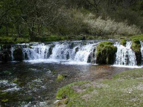
Descend now into an increasingly wooded Lathkill Dale. As you jouney further eastwards the track gradually grows wider. A woodland section starts properly after a waterfall, a green side valley leading of to the north and two gates and style in a stone wall.
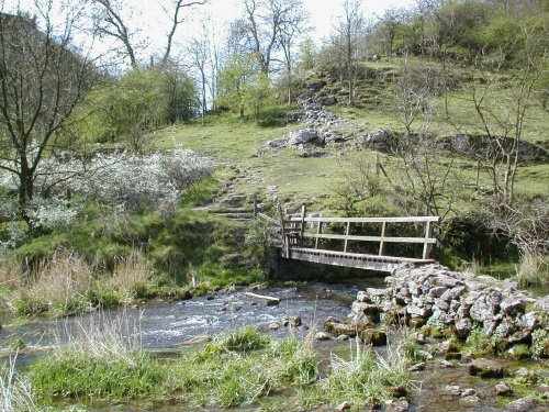
Many of the ponds, dams or compounds, whatever you wish to call them are today used to manage the water for fishing, however there is evidence of other purposes being more important in the past. Note the pair of millstones and also the fact that mining took place in the valley. You will discover mine workings at the track-side and the remains of an old bridge. The track emerges onto a road from Over Haddon at Lathkill Lodge. Here there is a ford and a clapper bridge, but do not cross, you must continue on this side of the river.
Here you pass larger fish ponds and then drop down though to Conksbury Bridge. Cross the road and cross the bridge. 200 yds up the road take a path between established woodland and newly planted trees. Cross a track leading to Haddon Hall and continue on into the fields beyond. Note the green summerhouse on the far bank. Pass through a series of gates and squeezers to arrive, past a stable, at a bridge with seat and phonebox in the village of Alport.
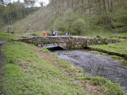
Cross the road and take the path opposite to walk up the valley of the river Bradford. Pass overhanging river cliffs to join a farm track. Continue up-river. Cross a flat bridge to the right hand bank, then across a road. Pass by a clapper bridge. There is a white cafe half way up the lane ahead. Note the old "Tea with Hovis" sign. At the bottom of the lane cross a stone clapper bridge, go through the gate and turn right. Up-stream you will pass a number of fishing ponds. Directly after a wall crosses the river on piles find a stone bridge (in picture). Cross here and take the switch-back path out of the valley on the far side.
Climb the path to a road, turn right and in 1/4 mile take a style on the opposite side to climb up parkland, cutting off a road junction. Climb the 3 step wall style to a road. Do not take the path opposite but turn left and take a style on the right. An obvious oblique path rises to a broken wall. Climb steeply over the hill, looking back at the view. A marker in a broken down wall points the way, bear right to a style by a gate. Pass past a picnic site and car park to a minor road, turn left and join another road in 200 yds. Take the path opposite, signed Monyash.
The path is obvious through 4 fields then woodland (don't fall down the hole in the wood - possibly a sink hole, a quarry or a mine). Cross one more field then take the diversionary footpath around Calling Low farm. Though the paddock, small wood, then onwards in a direct line. Ahead you see One Ash Grange and the track leading up from it. Cross more fields to come to Cales Dale.
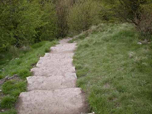
Descend the steps into Cales Dale (picture) and climb the other side to get to One Ash Grange. Steps at the side of a barn lead you behind the farm and by the icehouse (?). Follow the track straight up the hill, through a gate then continue in a straight line with the wall on your left. Cross this wall at the top of the field and continue onwards.
Through a squeezer to cross another dry valley, Fern Dale (NT). Over a 3 step style to continue in the same direction. Immeadiately join a walled lane by a gate and style, follow left and right turns. Let this walled lane lead you all the way back to Monyash.
Map:
Enjoy