Here's how to get to the Tissington Trail car park in Ashbourne.
At the top of the market place take the road marked "Tissington Trail and Cycle Hire Centre". It is not obvious. You pass the public toilets on the corner. Follow the road round to the right and then, at the top of the hill, carry straight on over the rise into a walled lane. The car park is on the right just down the hill a little way.
Street parking in Ashbourne is at a premium but you can park on the B5035 (leads off the main street almost opposite the turn for the trail car park) in front of the school.
Ashbourne to Waterhouses (to join with the Manifold Trail)
This links the south end of the Tissington Trail (at Ashbourne) with the Manifold Trail at Waterhouses. (Road route)
From the trail car park return to the road and turn right, down the hill. Follow the road along the flat valley bottom before passing over a small hill in a wood to (apparently) turn back yourself in another valley. Continue into Mappleton.
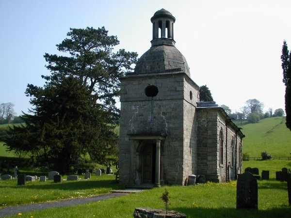
Turn left at the unusual church (picture), pass over a stone bridge and onwards up the valley, passing the entrance to Oakover Hall. Climb the long steep hill past the (smelly) farm to come to the crossroads at Blore Hall.
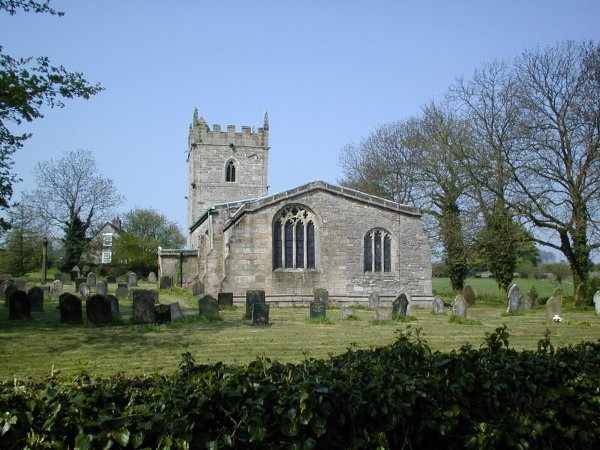
[Diversion left to see the church (picture)]. Go straight on at the crossroads. At a crossroads (note donkeys in field on left) with the main Leak-Ashbourne road turn right and then immediately right again for Calton. Pass through Calton turning neither right nor left eventually to re-join the main road just above Waterhouses. Descend the hill to take a track, right, just through the 30 mph signs. You are now on the Manifold Trail.
Map:
Hulme End to Hartington Signal Box:
This links the north end of the Manifold track to the Tissington Trail. (Road route)
At the top of the Manifold trail, turn right to pass through Hulme End and on over the hill to Hartington. Keep right through the village and ascend the hill to pass under a bridge which carries the Tissington Trail. Turn right just under the bridge to reach the car park, signal box and toilets.
This links the south end of the Tissington Trail (in Ashbourne) with the High Peak Trail ot Hopton Incline. (Road route).
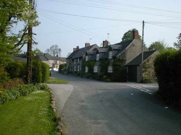
From the car park, return to Ashbourne market place and take the B5035 road opposite. Pass in front of the school - good place to park if too cheap for the car parking. As you leave Ashbourne take a minor road to the right signed Offcote. This quiet road is used to by-pass some of the B road and returns to it in Kniveton (Picture).
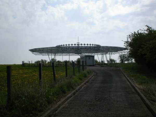
In Kniveton, turn right onto the B5035 and cycle up the hill. Pass the UFO on the hill (picture). Descend the hill (wheeeeee) past the Knockerdown PH to eventually reach a left turn signed Carsington and Hopton. Go through Carsington, pass the Miners Arms PH and on to Hopton.
As you enter Hopton, take the left opposite Home Farm. Climb steeply through woods. This is where you pay for the long down-hill you have just experienced. Bottom cog for me.
Over the top, you come to a crossroads. Ahead a bridge carries the High Peak Trail. Turn left and ascend the incline (on the road parallel to Hopton Incline) to join the trail by a gate on your right.
Map: