 |
 |
 |
 |
There were at least four bombing and gunnery ranges along the remote Cumbrian shoreline. Of the ones known to date, three of them were attached to RAF bases, with the fourth belonging to the Gun testing range at Eskmeals, near Ravenglass. Starting in South Cumberland and heading north, they were Silecroft (Millom), Drigg (Eskmeals), Mawbray (Silloth) and Burgh-By-Sands (Crosby-on-Eden).
The two observation posts are illustrated here, along with the direction arrow. There is a small post and a large post, though both are of a similar pattern. It looks like the sides - and tops - of the buildings were once enveloped in earth.
SILECROFT PHOTOGRAPHS: David Parkin, Heysham.
The Silecroft range was used by No:2 Bombing and Gunnery School (later to become 2 Air Observer School in June 1941) flying out of Millom aerodrome.
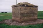
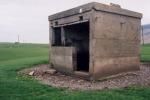
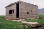
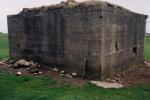
The buildings pictured below are on the shore at Drigg. The brick structure featured on the uppermost photographs is just off the path on top of the sand dunes (NGR: SD 047 984) and the lower photographs illustrate the post further south (NGR SD 055 970). The 'bus-shelter' style post is further north towards Seascale (NGR SD 048 994).
David Parkin - inveterate researcher for the RAF Museum at Millom - furnished me with the following pictures of the brick structure south of the path at NGR SD 055 970:
PHOTOS OF SOUTHERN OBSERVATION POST: David Parkin, Heysham
I am indebted to Edgar Iredale, who, when visiting the adjacent gullery some fifteen years ago, got talking to one of the nature reserve wardens and happened to point out this peculiar type of building. The warden at the time -a Mr Bland-Porter- remembers it being a gunnery range observation post, and remembers a chain of telegraph poles carrying a land-line along the beach from the posts to the gun ranges.
The mounting arc and the pattern of the slit in the front suggest that it would carry a telescope and / or plotting device, and have 180 degree vision. Edgar also told me of an aviation / nautical map of his that has the danger zones marked as an arc, fanning out to a mile or so North of where the post is sited. The OS map just has "Danger Area" picked out for the shore.
Andrew Holland lived at Sellafield from 1960 to 1969, and used to play on the beach as a child. He remembers a similar post on the sand-dunes sited between Seascale and Sellafield, and also remembers some wooden huts with a lift-up front and a radio antenna on the side which - he believes - replaced the brick structures, which were not in use at the time. I have vague memories of a family picnic in front of the Drigg building, but was unable to get in to explore! - I would be about eight at the time (1967).
Another building, long since demolished to make way for building work at BNFL / UKAEA, was above the sidings South-East of Sellafield station.
One can only speculate about the bricked-up windows, the roof "U"'s, and the concrete obelisks. I rather like the idea that the windows were on the original plans, but were bricked up on completion when it was realised that glass windows were not compatible with H.E. shell bursts!
My initial guess was that the inverted "U"'s were there to lift the roofs on, which would have been pre-cast, and the obelisks would have carried coloured marker boards. Sandy Forbes, a Civil Engineer with a background in heavy foundation engineering, suggests that for each building there were two identical slabs cast, one for the roof and one for the floor; the floor slab being an inverted roof slab. The inverted "U"'s must remain a mystery for the time-being, as the configuration shown would be totally unsuitable for the lifting of the roof slab.
The most likely suggestion given this information is that they were to anchor something to the roof obelisk, or to moor a balloon to for identification purposes. Another roof theory Sandy puts forward is that they were moulded originally for a different structure, and put to use expediently on these buildings.
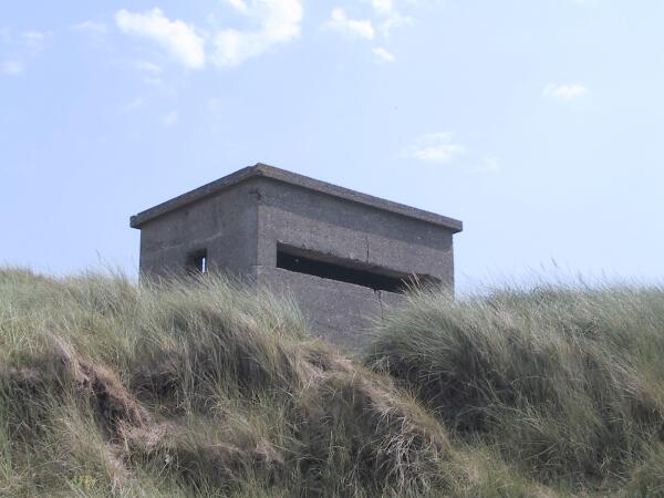
Not unlike a small bus-shelter in size and construction (except with thicker walls...), this post nestles in the sand-dunes several hundred yards further north up the coast towards Seascale. A horizontal observation slit extends almost the full length of the sea-facing wall, with a doorway to the rear, and a single loop-hole (if that is what it is) in the northern end. A small bracket and pulley remain attached to the NW corner, and was probably a telephone wire attachment.
I shall speculate further and suggest that the wire entered the post via a small square-section hole below the roof but above the loop-hole. There is evidence of a plugged mounting in the inside NW corner.
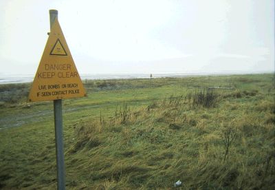 1982, and another explosive relic from
the last war is washed up on this outstandingly natural - and beautiful - part of the Solway
coast.
This recurring legacy of ordnance litter originates from the WWII bombing range, sited on Mawbray Bank, which was built for use by No:1 Operational Training Unit based at Silloth, a few miles up the coast. The only tangible evidence remaining of this range are the two concrete arrows, the associated identification circles, and the base of the observation tower.
There were two smaller targets further down on the beach for machine-gun practice, but they
have disappeared. The bombing range was controlled from an observation post,  or 'quadrant tower' nearby, which was accidentally "shot-up" by a trainee pilot during the early days! There are some corrugated, shuttered concrete remains adjacent to the arrows, which I believe to be the base of this observation tower. Mike Gregson of Aspatria provided the photograph of the remains.
Simon Ledingham took the following two 'pilot's-eye' photographs, for which I am extremely grateful. I wonder if much aerial attention has been paid to this little part of the Cumberland coastline since 1945!
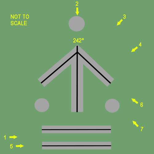
The graphic below shows the layout of one of the arrows. By clicking on the little yellow arrows and the associated number, you will be taken to a picture of the range-arrow from the direction shown by the yellow arrow. The picture-links are also available by clicking on the minature images below the graphic.
Mawbray was considered a suitable site to build a satellite airfield for Silloth, replacing the aerodrome at Great Orton. Although the plans were still pending in 1943, it never happened.
PHOTOGRAPHS: David Parkin, Heysham
The two concrete arrows are about forty metres apart, aligned along a direction of 242°. The larger one is 24.4 metres (80ft.), and was painted white, signifying "Smoke-Bombing". The shorter arrow is 12.2 metres (40ft.), and was coloured red to indicate live bombing practice.
The identification circles were used to indicate the arrow in use; the ones associated with the unused arrow were covered over. The targets were out in the Solway Firth.
This range stretched along the remote north Solway wetlands from Glasson in the west, through Drumburgh, and over to Burgh-by-Sands in the east. It was for use as a firing range by No:9 Operational training Unit based at RAF Crosby-on-Eden, east of Carlisle.
The photographs above illustrate the observation post near the Burgh-by-Sands end of the firing range, and are found near the King Edward I monument. Note the thickness of the concrete roof, which can clearly be seen from the fault-line. The scraped-away earth, the remains of the brickwork extending along the front line and the growth on the roof suggests that this building was heavily revetted.
Looking at the SW end picture (upper row, centre), three flat slabs of concrete can be seen about one metre forward of the front of the building. There are two steel eye-bolts protruding from the extreme SW and NE slabs, which were probably camouflage-net anchors.
Below is shown the quadrant-tower near Glasson, and a look at the remains of the Mawbray post suggests that it was of a similar design to this. It is interesting to speculate on the reason for the narrow chamber to the side of the tower!
The four aerial pictures below were taken by autogiro aviator Simon Ledingham, and show the Drumburgh range-arrow, the Burgh-by-Sands observation post and Glasson quadrant-tower as the aircrew would have seen them.
There are some nearby Nissen huts which may or may not be connected with the range. It has been suggested that these may have been for use by the local Home-Guard.
 Between the quadrant-tower and the observation post at Burgh (but nearer the quadrant tower) is a large concrete target guide-arrow pointing out to the target, which was located in the Solway Firth - a similar arrow to the ones at Mawbray and Silecroft. Close inspection revealed the presence of four concrete posts, forming a rectangle approximately 15' by 6'. One of the concrete posts still has a small chain and shackle attached, presumably to anchor a smoke-flare or marker flag.
The aircraft would have been guided to the target by the arrow, and the position of the bomb-drop would be recorded by telescope and sighting instruments located in the quadrant towers and observation posts. The resulting information was passed to the aircraft by radio.
The photograph below was taken in the 1980's by the late Gilbert Rothery of Workington.
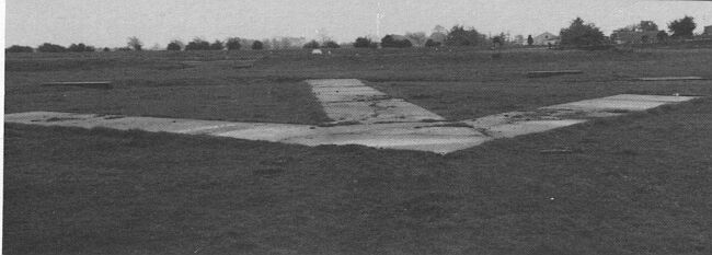
PHOTOGRAPH © G.Rothery/Millom RAF Museum collection.
Home | Contents | Workington | Links | E-Mail