|


| |
Route
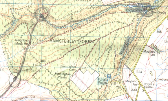
| According to the chief scout challenge specifications we had
to plan and carry out an expedition in unfamiliar country over 3 days including at least 2
nights out of doors, along a route more than 24 km. To do this successfully we had to plan
an accurate route which crossed or met rivers, streams or tributaries along the way. After
the 2 meetings on the chief scout challenge we came up with a route which stretched 65.5
km and included 1 night in a camping barn and 2 nights out doors at different campsites. |
Route Card
Description |
Grid Ref |
Dist. KM |
Day |
Total km walked that day |
| 1)Round About |
191,289 |
- |
Friday |
|
| 2)Camping Barn Witton Castle |
155,305 |
5 |
Friday |
5 |
| 3)Black Hill Farm |
098,308 |
6 |
Saturday |
|
| 4)Cross Roads in woods |
030,296 |
7 |
Saturday |
|
| 5)Campsite Eggleston |
989,246 |
8 |
Saturday |
21 |
| 6)Mine Workings |
973,301 |
8 |
Sunday |
|
| 7)River Fork |
980,318 |
2 |
Sunday |
|
| 8)Road T-Junction |
998,308 |
4 |
Sunday |
|
| 9)Cross Roads |
036,342 |
6.2 |
Sunday |
|
| 10)Path Next to Stream |
050,347 |
2 |
Sunday |
|
| 11)Campsite High Shiply |
114,331 |
7.3 |
Sunday |
29.5 |
| 12)Howden Le - Wear |
162,334 |
10 |
Monday |
10 |
Total |
65.5 |
|
| Scouts accommodation Friday Night
Witton Camping Barn 01468 62252
Witton Le Wear
Saturday Night Bend Holm Caravan Park 01833 650457
Eggleston
Sunday Night High Shipley Farm 01388 746620
Hamsterley
Leaders accommodation
Friday Night Witton Camping Barn 01468 62252
Witton Le Wear
Saturday Night Baldersdale YHA 01833 690000
Sunday Night Mrs. Seymour B & B 01388 832455
High Wether Hill |
|
Back to Top

|